What do the distinct stages of acquisition for fixed wing, helicopter, and mobile LiDAR mapping projects look like?
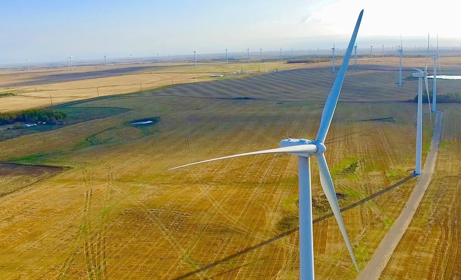
Large Area (83,200 Acres) Piloted Imagery and LiDAR Acquisition + Mapping
The high-accuracy mapping products that the DroneView Technologies team can create have been made possible thanks to incredible innovations like RTK/PPK-enabled fixed-wing and multi-rotor drones, aerial LiDAR, terrestrial LiDAR and bathymetric mapping systems. However, it’s the people who define these systems and processes that make the real difference. It’s people who determine what it means to capture the right amount of data, why using LIDAR imagery is going to be best for a given project or what benefits drone surveying for renewable energy projects can enable.
Lucas Wilsing, Director of Client Services at DroneView Technologies, is one of those people. He works with clients on a daily basis to address the technical intricacies of projects as well as fundamental aspects of communication, trust, and efficient data delivery that define any mapping project. In the interview below, he answered questions related to all of those topics. He also explained the importance of upfront consultation, the long-term benefits of capturing dense data, the importance of communication, new opportunities with PLS-CADD and more.
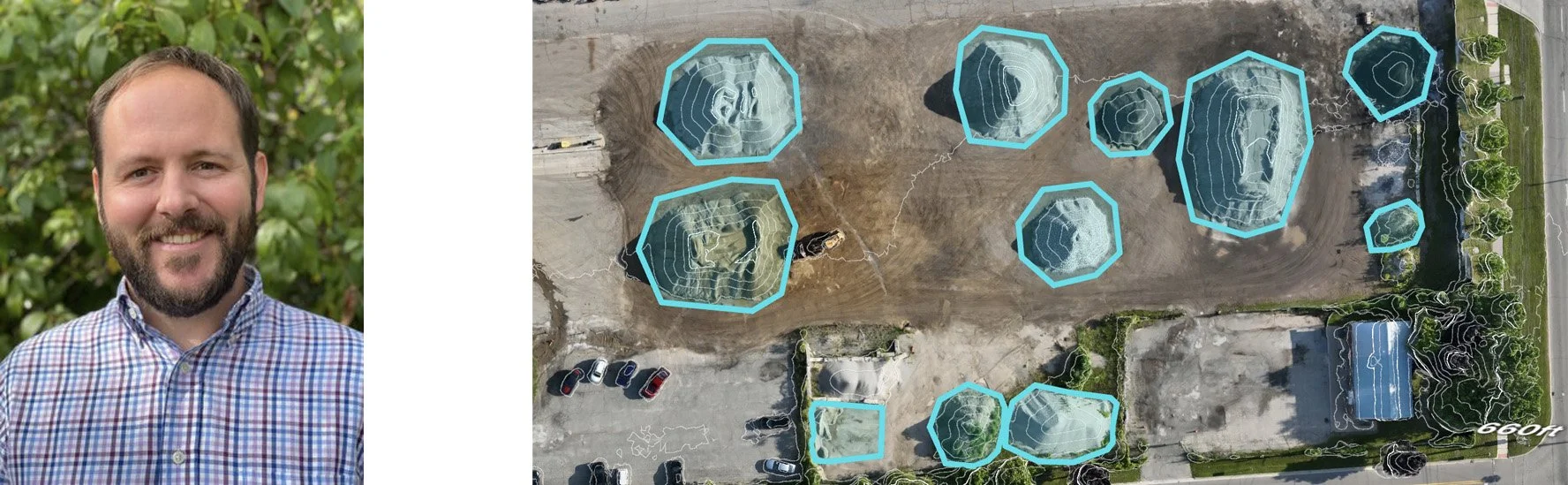
Lucas Wilsing alongside an example of one of the many types of products delivered by the DroneView Technologies team.
Your skills and experiences are centered around remote sensing with the primary focus being aerial LiDAR/imagery and Mobile LiDAR, so what can you say about the options and opportunities that are enabled for clients when this type of data is captured?
Lucas Wilsing: The first thing I’d say is that we're agnostic to the hardware and the platform. Jason Heywood talked about this in detail, but we have the availability to leverage teams and expertise that is located across the country thanks to a network of aerial imagery and LiDAR data acquisition partners, so it’s not just about the capture method or the tools being used, but about the team using them. We put what we think is going to be the best team and technology on a given project, which is why we can potentially provide higher densities and higher capture rates.
It can make a big difference because high data densities and overflying areas (specifically from a manned aircraft approach) help extend data shelf life and cover possible add-on focus areas. With the appropriate hardware and flight conditions, we significantly reduce the amount of fieldwork required and provide high-accuracy mapping in remote areas that may be very challenging to access. But our solutions aren’t just about the data we capture.
What do you mean?
Lucas Wilsing: Public data is also an option and allows DroneView Technologies to remain in the conversation when the budget is tight. There’s a great deal of data that’s available to the public through the USGS. They have a very good bank of public data that we utilize if the scope of the project isn’t especially large, or if that data might be good enough for what we're trying to do.
We always talk about using the right tool for the right project, but it’s also about the right type and kind of data. We need to be careful to not over-engineer things. We want to deliver super-accurate products, but that accuracy has to line up with what is actually required.
How do costs factor into that alignment?
Lucas Wilsing: When you start talking about costs, there’s a tendency to focus on what’s available to someone at the moment, which could be their own drone or just looking on publicly available information. Those are relatively inexpensive options, and then we come with a manned aerial scan that could be 10x what they had envisioned. That’s not the option we put together because it costs more, but because it’s one we believe is right for what they need.
That can be a difficult conversation, but I would rather have that conversation than get halfway through a project just to realize it’s not going to work. That’s why we try to do all of that education up front so our clients can really understand what we do well.
And how much of that education is about letting someone know what you can do well, but also what the limitations look like?
Lucas Wilsing: It’s very important, and an example I can give of that is flying leaf-on/crop-in scenarios assuming that LiDAR is going to get everything they need in heavily vegetated areas. That most often occurs when we’re dealing with a rushed project timeline. They’re asking for more than the technology can provide, which can result in a significant increase of fieldwork. In some cases, it requires requisite re-flights with better conditions.
Everyone needs to be on the same page with those types of limitations and possible results before we get started.
Are there long-term benefits associated with the capture of LiDAR data? Have you seen this type of information leveraged months or even years down the line by clients?
Lucas Wilsing: Absolutely, especially if the LiDAR data is captured at a high density (such as 30-50ppsm +) that allows users to extract additional features as needed in the future. That’s something you see with an asset like a transmission line. In fact, overflying an area (0.25 mile buffer or more with a manned aircraft approach) can allow clients to meet tight ‘add-on’ processing deadlines and prevent further fieldwork or new flights.
It’s the exact type of support we want to highlight because as we overfly project areas, we can improve densities. And when you’re talking about power lines and utility assets, that’s a ramp to improve the grid. We grab a lot of planoimetric and topographic data which means we need to capture the data at a higher density. This wealth of data can be leveraged by other teams and groups within the organization, proving that this information can be as powerful as it is versatile.
So what does that client education piece look like? It’s not one thing at a given time with a certain person, but there have to be parameters around when you talk about those initial expectations and future possibilities.
Lucas Wilsing: It’s really about asking and exploring what a given project needs and going from there. With most of our clients being surveyors, it’s not about what we can do, but how we can help them in a way that saves them time or gets something done quicker. So instead of them spending a week in the field for a given project, it’s something we support in a couple of days.
But we also have clients who think because they have LiDAR on an aircraft or own a drone they can do anything they need. Or if they have both, they’re doubly covered. Both could be true, it’s just not a given. It can also mean getting boots on the ground to provide additional context and insight for that education.
Whether it’s digital elevation modeling, hydrographic mapping or anything else, it’s always about underpromising and overdelivering.
Let’s talk about what happens once you’ve established those expectations and are moving forward with a project. Can you talk about the distinct stages of fixed-wing, helicopter, and mobile LiDAR projects and what happens in each on the DroneView side?
Lucas Wilsing: Six distinct phases define our workflow, and even though we’re dealing with projects that vary in length and scope and countless other variables, they all fall into this same pattern that I’d break them out in the following way…
Phase 1: Select the correct platform and sensor/s based on multiple variables (project purpose/scope, subject matter, etc.)
This is about selecting the correct platform and sensor based on multiple variables. We’ve talked about the right tool for the right job, and this phase is about working that all the way through. What's the purpose? What’s the scope? What is the timing? All of that is in this first phase.
Phase 2: Mission planning factoring weather and temporal variables
I mentioned the timing in the first phase, but timing is about much more than a date on the calendar. This phase is about timing as part of mission planning. How are we flying this? What are the FAA rules? What are the specs? All of that gets factored into phase two, at which point we’re reaching out to the DroneView trusted partner network to get things lined up.
Phase 3: Flight/scan/collection
This is the actual fieldwork, which is done by contacts from a network of aerial imagery and LiDAR data acquisition partners. This data needs to be right the first time, which is why our internal team is connected to this entire process. These acquisition partners are part of our trusted vendor network for a reason though, and we expect it’s going to be captured properly before coming in-house.
Phase 4: Field/Data acquisition QC
Our QC phase is so extensive that we can break it out into two parts, and the first one occurs in the field. This happens while the project is still ongoing, and we're actively communicating with surveyors or pilots to verify the accuracy and completeness of the collected point cloud and imagery data. We make sure there are no shadows, that the accuracies are as they should be, etc. We want to have all of that firmly established before it gets into production.
Phase 5: Initial in-house data QC
After that initial QC, our in-house certified photogrammetrist will take over and perform the second part of that QC to ensure we have what we need. It doesn’t happen often, but sometimes things do get missed in the field, and this second QC ensures we identify any of those misses or additional needs sooner rather than later.
Phase 6: Production
After we know we have everything we need, our team digs all the way in to turn that data into the assets that our clients need. That’s an entire process in and of itself on our side, and the specifics are obviously project-dependent. But this is the stage where we’re working to ensure those maps and other assets are exactly what our clients are expecting.
Your Mapping Production Manager and Director of Geospatial Services are very much involved in those later phases, and we’ve detailed what some of those specifics look like, but can you talk a bit more about the DroneView network of aerial imagery and LiDAR data acquisition partners that support the earlier ones? How are you relying on this network, and what makes it distinct?
Lucas Wilsing: There are countless firms and individuals out there that want to fly. They want to get in the air and will tell you about all the things their sensor or drone can do. But can they deliver? Are they going to be able to do what they say they can do? If someone is in the DroneView Technologies network, we know they can, and that’s the difference.
We've been doing this for a long time. We know the people who are flying these systems. We know the right systems to use, what the price points should be, where the ideal locations are at, etc. We have relationships that few can match.
And that’s not to say there’s a level of special treatment. It’s not that our relationships allow us to offer a service at an actual discount, but because we can work with teams to sort out how they can fly three jobs in the same window instead of one, you can get better pricing. And that also makes my life a lot easier.
Being able to establish those relationships and processes isn’t something that happens overnight. And there were times when it was bumpy. We fixed some processes and stopped using some folks, mostly because the communication wasn’t there. I would only give work to people who I know are going to get it done, We use the right people, and that’s something I push because it’s not just about the hardware, but about the people who are flying and using all of these tools.
And all of that is the foundation for efficient quality data deliveries, which is something you’ve called out as a focus. But your mention of relationships highlights the importance of the people involved, so are those sorts of deliveries more about people or process? Are there any major commonalities between successful deliveries?
Lucas Wilsing: If I had to give the nod, I would say, people, right? We work with good people and have established good communication, which makes things go the way we want. But of course, a good process needs to be part of all of that.
From getting data in-house, to accurately working through project timelines and product expectations with clients, communication is king. Our production workflow/process is good and while there’s always room for improvement, working with the right people, who communicate well, is a recipe for success.
Where I sometimes see challenges with survey clients is when their project managers are not properly supporting their CAD Teams. We may have data or may be able to easily provide supporting files that a client’s CAD Team requires to submit to the engineer. This can be improved with better communication between our team and a client’s processing team.
The commonalities are all about understanding our client's expectations and limitations, and then having that same type of understanding around expectations and limitations with our team. Sound communication and a strong QA/QC process is the major commonality with any on-time and successful data delivery.
It sounds so trite when we’re dealing with incredibly technical high-accuracy mapping and geospatial solutions, but the hardware and software are somewhat secondary in this context, aren’t they? The biggest challenges arise when you don’t know what’s happening with another team or where things are in the process.
Lucas Wilsing: It’s something I’ve experienced firsthand, which I why my solution is to just pick up the phone and ask a question when I’m not sure. Understand what they're thinking. Don't just guess or impose a three-to-four-week timeline. Call the client and really understand what they’re trying to accomplish, and if we can't accomplish it, let them know what we’re going to do to come up with a different solution that might work for them.
That approach takes the stress off production on our end as well, which keeps everything seamless.
Have your responsibilities with report creation helped clients define the value and ROI of your services? What kind of a difference can drone surveying for flood risk assessment make when compared to a traditional or less involved approach?
Lucas Wilsing: With most of our clients being surveyors, the ROI of our services is oftentimes quickly recognized as our work can significantly reduce their field time and improves data accuracy. We're also flying this stuff at a larger scale, which makes us stand out from the competition.
But more and more of those surveyors are getting their own UAV hardware, so we take a consultative approach to ensure data is being acquired and processed correctly. Our scheduling and communication make us stand out in both respects in a way that our clients can calculate when it comes to time in the field, whether it’s their teams or ours.
Does that variety of services differentiate the high-accuracy mapping and geospatial solutions that Droneview Technologies provides?
Lucas Wilsing: We want our clients and potential clients to know they have options. It’s not just about our full scope of service, as we have plenty of clients that we support in different ways when the initial project is done. We’ve got full aerial imagery and aerial LiDAR services, but if you just want to learn how to use the drone you’ve purchased correctly, we can support that.
Whether we’re there to deliver or support, our commitment to communication and scheduling with deadlines in mind really does stand out though. We talked about the communication piece, and if you compare us to some of our competitors that are utilizing similar sensors and geospatial experts, we stand out there but also when it comes to project scheduling. We respond quickly to proposals and offer competitive project schedules, and we do not miss deadlines.
What’s one thing you want clients and potential clients to know about how you can help them solve their biggest challenges?
Lucas Wilsing: Top of mind for me is PLS-CADD. A lot of companies in this space have overflow processing needs that we’re in a prime position to support. I recently learned one of our bigger clients was unaware that DroneView Technologies had PLS-CADD processing capabilities, and that’s something we’ll be pushing in a big way. We have the capability, so call us to explore what’s going to make sense.
Something I also want to highlight is that we can support clients nationwide on a large scale. We can do this with our network of manned acquisition vendors and the ability to scale our production team. With larger block acquisitions and project bundling, we’re also in a position to reduce data acquisition costs. We’ve been talking a lot internally about grid updates and what sort of benefits mapping assets can provide with network planning and optimization.
But I really want to highlight our network of trusted vendors, not only because of how we’ve used it to solve problems, but because of how unique it is in the space. There are lots of companies that provide high-accuracy mapping and geospatial solutions, but this network allows us to support projects of all scopes. We have an amazing internal team, but our network of pilots and surveyors is much larger and that’s what more people need to realize. When they work with us, they’re tapping into an entire network of expertise.
Have your own question for Lucas? Get in touch with the DroneView Technologies team or connect with him on LinkedIn to ask.